Considered the "best prospect in the district" by the California State Mining Bureau engineers. A well identified resource for
high-grade gold recovery. Possibly one of the richest areas
you will ever find to prospect.
Extraordinary 920-acres of recreational & hardrock gold mining opportunities. Over $3-Million in gold recovered worked simply by hand! Serious to casual / recreational gold mining opportunities are abundant.


Name
Trail Creek
Trail Creek West
Trail Creek East
Trail Creek Central
Trail Creek Stage
Trail Creek Entrance
T39N, R10W, Sections: 11, 12, 13, 14, 23, Mt. Diablo Meridian
Names Of Fifteen Prospects Encompassed Within
Trail Creek 1-4, Fortune, Frost King, Bull Calf, June Bride, Bullion, Homestake#2, Trail Creek Placer, Highland, Short Mine Quartz, Short Mine Placer, Blue Eagle & Black Dike. Map
Access
Easy to moderate. Pavement to hardpack dirt road to apprx. 2-mi. trail along Trail Creek to the mines.
Mining District
The properties are located on Trail Creek in the Salmon River Mining District, Siskiyou County, California. Centered in one of the largest mining districts in Northern California - The mines in this district have produced millions of dollars in gold. The elevation is seven-thousand feet.
Property History & Developement
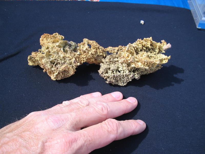
The Trail Creek Mine history dates back from about 1906 with its discovery by an old prospector from a "trace" of gold on the surface leading to an outcrop of gold bearing quartz approximately nine inches wide. Some time later the "prospect" and claim were sold to a group of miners who drove a tunnel to the ore at a depth of 80 ft.. At the 80-foot level the vein of gold-bearing ore had increased in width to 4 feet. When the tunnel reached the rich gold ore a small mill was packed in by mule train and installed in a log building. Approximately 4000 tons of ore was taken from an ore shoot 250 feet long and produced over $48,000 in gold (apprx. 2,400 ounces of gold at an estimated $16 - $20 oz. - Approximately $3M at today's gold price).
In order to increase the amount of ore for a larger mill and improve mining methods, a long lower tunnel was started down on the mountain side below the upper tunnel. There is a vertical distance between tunnel levels of 150 ft.. This tunnel was driven a very short distance when extremely hard rock was encountered and a large amount of money was spent over a period of time. If heavier and more efficient machinery had been installed for handling the hard rock, there is no question but that the orebody would have been reached and the mine would have continued mining and milling.
Death of two members of the operating group and WWI practically brought the development of the mine to a standstill. However, the two remaining miners continued to drive the tunnel ahead by hand until 1927.
With a production of $48,000 in gold to its credit, (at an estimated $16 - $20 oz.) the character and structure of the ore-bearing vein gave the mine what Old-timers term an excellent "prospect". The mine at that time was considered the "best prospect in the district" by the California State Mining Bureau engineers in their Fourteenth Report (1913 - 1919, page 841). However, the mine still needed extensive development and exploration to prove the size, depth and richness of the orebody. Technical knowledge concerning the development of the mine was then entirely lacking.
In 1927 a buyer by the name of; Mr. Latchem, purchased the property from the two remaining miners of the original operating group and continued to drive the lower tunnel toward the vein of rich gold-bearing ore. The all-important problems still facing the operation at that time which would determine its future success or failure were; 1.) Depth. Depth is of primary importance for a large mine. 2.) Width. Would the vein increase with depth? 3.) Values. Would these increase the depth?
In order to determine these important requirements it was therefore necessary to complete the tunnel to the orebody. As driving the tunnel progressed, considerable geological information was compiled and from this correlated information several very important developments were noted. Geological data pointed to a much larger mine than was at first anticipated.
A short time prior to the Government Limiting Order L-208 dated October 8, 1942, closing all gold mines, the tunnel reached its objective, which was the downward extension of the orebody worked in the upper tunnel. THE RESULTS WERE HIGHLY SATISFACTORY. The vein of gold-bearing ore was seven feet wide, a large increase over the four-foot width in the upper tunnel.
Gold was distributed throughout the entire width of the vein and had not diminished in value in this additional depth to the lower tunnel. For the twenty-foot advance into the orebody, at the time of the Government Closing Order, samples of ore were running from $11.78 to $70.00 per ton (equal to 1/2 oz. to slightly over 3 opt ). On the theory of parallel veins, a decision was made to drive a prospect tunnel into the unexplored area to the right of the present tunnel. At a distance of one hundred and twenty feet, a six-foot vein with gold-bearing quartz was struck, establishing evidence that the two veins thus far explored have depth and excellent width for profitable mining. Diagram
Geology
It is reported that the background of the mine is a massive grano-diorite batholith; then comes in succession a series of schists, fine grained dioriteintrusives, a carbonaceous schist and other intrusive's. The veins are in a true fissure through schist diorites with gouge on both walls with a general dip of about 67 degrees average. In development work on the surface as well as underground, there is no evidence of faulting. The ore is composed of silica (quartz), small amounts of magnesian lime and iron pyrites, carrying quantities of free gold and gold in combination with iron sulphide. It is simple ore requiring concentration for the recovery of the sulphide content.
Future Developement & Exploration
With present mining techniques and modern machinery, and large areas yet to be explored, the possibilities can be readily seen. Operation costs should be low because of the following factors; 1.) Large amount of timber on the property for all mining purposes.
2.) No pumping required; ample free water for mining and milling purposes. 3.) No hoisting costs or metallurgical problems.
From the advance of 20 feet into the orebody in the lower tunnel it appears quite likely that it may continue for the same distance as worked in the upper tunnel which was 250 feet and should give a substantial block of ore. Like other mining operations in the area, continued operations and profits will depend upon further discovery and development.
Source
1947 SALMON RIVER MINES CO., E. C. Latchem, Mine owner and operator, Final Prospectus Report
Wm. M. ARENDT, Geologist and Mining Engineer
Regarding the Bull Calf, Frost King, & Original Highland Mines
The following is a copy of a report from W. H. Arendt, Geologist and Mining Engineer, to; E. C. Latchem, then President of the Salmon River Mines Company, regarding the acquisitions of the adjacent properties to the Trail Creek Mines; The Bull Calf, Frost King & original Highland gold mines;
This is pocket-gold country! Enjoy looking for sources of gold - Possibly life-altering gold values. This region gold photos
If you're looking for an extraordinary group of gold properties located off the beaten path but not too far from operational provisions... An exceptional collection of gold claims that offers more than the usual area to prospect for gold in a region that's well known for its big gold history and present-day gold discoveries, then this is a listing you might want to consider.
A gold property collection that is prime for gold-finding exploration.
In discovering just 1-vein occurrence, should produce approximately $20M
The State of California Division of Mines has documented that most single vein occurrences is about $20M at today’s price. In most instances, there were/are multiple fault/vein systems within each of these mines.
This group of gold properties is for anyone looking for a massive area to prospect for great gold in this historically gold-rich region. Aside from the excitement for the possibility of finding gold by use of any number of casual recreational gold-finding methods, this uncommon group of gold properties also provides the prospect for strategic early stage surface and underground gold development projects. The tunnel areas are fairly well defined where the old timers began their operations. What might be extremely rewarding at this time is to investigate with some modern-day applications by use of simple sampling techniques using detectors and portable back-pack drills. The information contained within this presentation points to significant exploration potential of the properties as a whole, where there has been very limited exploration drilling from surface and underground. As gold mining is approaching a long period of new found activity, this company believes that it is presenting an exceptional opportunity for the realization of untold profits in gold reserves.
The Trail Creek Mines is a large collection of gold properties that offers much in the way of versatile possibilities; It is large enough to split into several sections; sell a few and keep others, lease parts or all, offer JV's, keep favorite sections that you can enjoy for your own use and hand down to family members, hold parts or all for speculative reasons, etc.. A collection this large offers many different options.
At A Glance
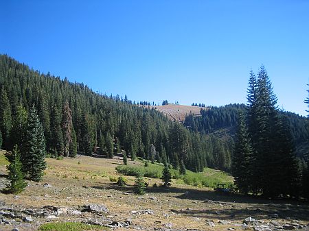
- An extraordinary 920-combined acres located in the Klamath National Forest in Siskiyou County, CA. A large collection of gold properties that offers much in the way of versatile possibilities. Prime for all types of gold-finding exploration.
- A well identified resource for high-grade gold recovery; This is a property where one can honestly & literally say, "X-Marks the spot! ". 3 known mines - 15 known prospects; "The vein of gold-bearing ore was seven feet wide a short time prior to the Government Limiting Order L-208, (closing all gold mines in 1942). Gold was distributed throughout the entire width of the vein - Samples were running from 1/2 oz. to slightly over 3 opt".
- Considered the "best prospect in the district" by the California State Mining Bureau engineers. A serious amount of gold recovered having been worked simply by hand; 2,400 oz. / Over $3M at today's gold price.
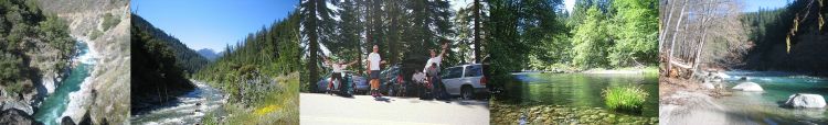
- Remote, secluded, terrifically scenic, easy to explore. Offers easy access to comfortable creekside campsite & surrounding gold prospecting lands.
- Unique wide-ranging opportunity for gold mining ventures - Geared toward casual use during holiday vacations - the weekend enthusiast to the seasoned prospector.
- Hundreds of acres of quartz-filled rock outcrops. Every inch of this collection needs to be detected.
- Apprx. 2-miles of creek (Trail Creek) cutting through known gold-bearing land.
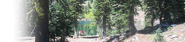
- Access to a clean mountain lake.
- A natural spring for drinking water.
- Remarkable speculative investment opportunity. Work the properties or hold (them) in the event of patenting being reinstated or the price of gold going higher.
- Hundreds of thousands of ounces in gold reserves estimated in a high-grade gold region that has yet to be explored by modern means.
It has been called to my attention that you have acquired the adjoining northwesterly property consisting of the Bull Calf and Frost King mining claims, the former locations of the original Highland Mine, first located in the 1880's. Diagram This acquisition is an important one and should add appreciably to the value of your holdings and no doubt increase potential ore reserves to a considerable amount.
Shortly after the organization of the Salmon River Mines Company in 1932 the company endeavored to purchase this property and made several attempts during the intervening years to arrive at a purchase price satisfactory to the individuals concerned, but not until after the death of the former owner was it possible to acquire title to the property for three thousand dollars ($3000.00) to be paid on a royalty basis of ten percent (10%) of gross returns from ores extracted from these two claims. The fact that Salmon River Mines Company controls all water rights to Highland Creek and Siphon Lake and the only road into the district no doubt was a great advantage in obtaining the Bull Calf and Frost King claims at this most reasonable figure.
In checking the history of these two claims, it has been determined that unoxidized ores and the presence of gold contained in pyrite prevented successful recovery of values by amalgamation, the only feasible method that was possible in what was then an almost inaccessible location. Unless an ore in those early days of hard rock mining carried a high percentage of free gold, there was little possibility of success in recovery of values. It has been reported that No. 2 Highland Tunnel produced ore valued at $60.00 per ton with recovery from stamp milling and amalgamation practically nothing. With this condition existing, subsequent development work was confined to prospecting the surface for free gold. All the work of the sinking shallow shafts, digging open cuts and running drifts on the steep hillsides has been a great advantage in exposing the veins and making it possible to determine that the possibilities for large scale development are present. Sampling has shown the presence of gold values but has not been adequate to show the presence of any commercial orebodies and further exploration and sampling should be conducted to ascertain whether mineable orebodies can be located. Concentrate from a "grab" sample from this property assayed $2,047.50, the ore $19.60 from a 6 foot vein.
The vein system on these two claims is continuous throughout their entire length and beyond, northwesterly, and can be readily identified on the entire surface; likewise, these same veins continue southeasterly through the Trail Creek claims a total distance of over 12,000 feet. Values on the vein have been established at frequent intervals throughout the entire length of the exposures, but sufficient work has not been done to establish the definite boundaries or lengths of the ore shoots, evidence of which is easily demonstrated. Geologically the vein system described and ore deposits visible on the surface are identical to those on the Trail Creek claims.
Due to the topography of the area, it will be found that the highest point on the Frost King claim is about 750 feet above Trail Creek Tunnel No. 1 at which point the vein is exposed in an open cut and has a width of 20 inches; northwesterly and at an elevation 200 feet lower this same vein has a width in excess of 5 feet and shows values believed to be sufficient to produce profitable milling ore. Proceeding southeasterly from this last opening toward Trail Creek No. 1, samples panned from open cuts, tunnels and shafts have given indicated values up to $50.00 over widths up to 6 feet. These demonstrated values justify a development plan that would expose this deposit for its entire length which backs up to about 750 feet vertical height at its highest point above Trail Creek Tunnel No. 1.
It is suggested that these two claims be prospected first by making frequent cuts on the surface with a bulldozer at points now known to show values, then cuts to expose the vein at more frequent intervals to determine the length of shoots; subsequently to crosscut from a point across the gulch from Trail Creek Tunnel No.1 and at the same elevation until the vein is intersected, then drift along the vein as far as necessary, thus proving the presence of ore and placing the mine in a condition ready for production.
Conclusion: I have had your property under observation for sixteen years and have been in a position to study the geological formations and mineralization of the area though that time. The former owner of the Bull Calf and Frost King claims gave me every opportunity to study these two claims and imparted information to me that was not generally known since he personally conducted me over the ground, describing each excavation and stating values which were later checked by me. I believe you have acquired a piece of property that should, upon completing the above outlined development, demonstrate the presence of ore in sufficient tonnage to warrant a large scale production program. The analogies of the vein system on the two newly acquired claims are identical to those in the Trail Creek claims wherein it has been thoroughly demonstrated that the ore definitely increases in width with depth and that values are maintained.
March 8, 1948
W. M. ARENDT
Geologist and Mining Engineer
Property
The Trail Creek property consists of 6 unpatented mining claims;approximately 920 contiguous acres, located and held under the mineral laws of the United States described as follows;
Property Information
Acreage CAMC#
160 ac. 0286240
160 ac. 0290278
160 ac. 0290277
160 ac. 0290279
160 ac. 0290280
120 ac. 0290281
Situated in the middle of 3 major wilderness areas...
Separated from the Redwoods only by the coastal range...
Vast beauty, Lesser-traveled, Adventure, Excitement...
Extreme Northern California's Gold Rich Salmon River Region
It's a wild place to explore


In Summary
The Trail Creek Gold Mines Properties offers a vast variety of methods to choose from for finding gold in one of the richest gold mining regions in the U.S... Serious to casual / recreational gold mining opportunities are abundant. This is a comfortable array of gold properties for recreationally mining if that's all you want to do. You can work the properties &/or or simply hold them as a speculative investment opportunity in the event of patenting being reinstated &/or the price of gold going higher, or start right back up again with serious operations where previous owners left off with the possibility of recovering hundreds of thousands of ounces of gold. These properties offer real potential for becoming a long term high-grade gold producer that offers a mix of advanced-stage development and continued exploration projects in a region rich in gold. A collection this large offers its owner many different options.
The Claim Post. High Grade Gold Properties For Sale. © Copyright 2003 to present. All rights reserved.

World-Class gold properties for sale
The Claim Post
...the most trusted name in gold property listings.
A World-Class Gold Property Listing
The Trail Creek Gold Mines
920 combined acres - 6 contiguous unpatented mining claims
Salmon River Mining District - Siskiyou County, CA
In a region highly prized for its richness in gold
est. 2003
Contact Us!
Respectfully,
Please be aware that mining claims are federally protected.
Anyone found prospecting a mining claim without express consent from the owner can be charged with criminal trespass and theft. Our properties are closely monitored. Please be certain to contact us before visiting any of our gold properties.
We show you gold right from the start!
$2,900 down / $999 mo. Terms
Sale price; $399,000